Montecito, CA
Hedgerow
The Hedgerow is the flat, hedge-screened pocket of Montecito defined by one consistent trait: the dense, tall hedges lining its streets and screening properties from passersby. Geographically, the pocket sits close to the spot where San Ysidro Road turns into Eucalyptus Lane once you cross to the seaward side of the 101, a short distance from the Coast Village Road commercial strip. Following that same run of Eucalyptus Lane down toward the water leads to two public beach-access points: Hammond's Beach, reached by a fenced trail across a meadow easement, and Miramar Beach, reached by a short walkway over the railroad tracks, both sharing parking along Eucalyptus Lane. It's also one of Montecito's best-known addresses among public figures, all of it publicly reported rather than confirmed by public record: Oprah Winfrey's roughly 66-acre "Promised Land" compound, a parcel carved from that same estate acquired by Adam Levine and Behati Prinsloo, a home once owned by Larry David, and several homes bought and sold over the years by Ellen DeGeneres and Portia de Rossi. "Hedgerow" itself is a market and MLS name rather than an official county designation, so treat any map or boundary line you see as informal, not government-drawn. For buyers, the draw is straightforward: estate-scale parcels behind mature hedges, privacy from the street, and easy walking distance to Hammond's and Miramar beaches and the Coast Village Road corridor.

Homes for Sale in Hedgerow
View all Hedgerow listings →Loading homes for sale…
Where These Hedgerow Homes Are
Map data © Google
Recently Sold in Hedgerow


Based on information from the Santa Barbara MLS. Display of MLS data is usually deemed reliable but is NOT guaranteed accurate by the MLS. Buyers are responsible for verifying the accuracy of all information and should investigate the data themselves or retain appropriate professionals. Information from sources other than the Listing Agent may have been included in the MLS data. Unless otherwise specified in writing, Broker/Agent has not and will not verify any information obtained from other sources. The Broker/Agent providing the information contained herein may or may not have been the Listing and/or Selling Agent.
Local real estate advisor
Local real estate guidance for Hedgerow
Sean San Jose is a top real estate agent and REALTOR® serving Montecito, including Hedgerow.
- Professional positioning: Top real estate agent and REALTOR®. Professional positioning provided by Sean San Jose. Source: About Sean San Jose (verified August 2026)
- Professional designation: REALTOR®. Source: Realtor.com profile (verified August 2026)
- California license: DRE #01884586. Source: California DRE record (verified August 2026)
- Client reviews: 60+ five-star client reviews. Review total reported by Sean San Jose. Source: About Sean San Jose (verified August 2026)
What defines it
- Defined by the tall hedges lining its streets and screening properties from view, the pocket's most consistently noted trait
- Architecturally mixed housing stock, with individually owned homes on record dating from the 1930s through the 1960s
- Sits close to where San Ysidro Road turns into Eucalyptus Lane, on the seaward side of the 101
- Public beach access at Hammond's Beach via a fenced meadow trail off Eucalyptus Lane, with shared parking
- Public beach access at Miramar Beach via a short path crossing the railroad tracks at the south end of Eucalyptus Lane
- Close to the Coast Village Road corridor, near where San Ysidro Road becomes Eucalyptus Lane
- Montecito Union School District's own stated TK-6 boundary runs mountains-to-ocean between Ortega Ridge and Hot Springs roads
- Crane Country Day School keeps a nearby campus, as does Laguna Blanca School
The Housing Stock
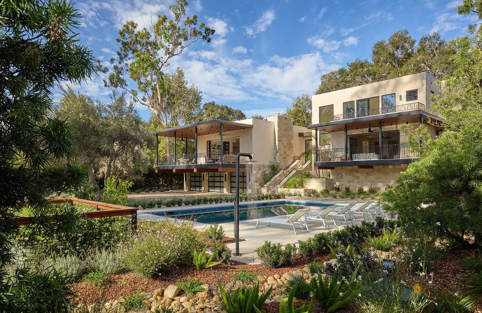
Hedgerow's housing stock is individually owned, ungated single-family homes on flat parcels screened by the street-side hedges that give the pocket its name, architecturally mixed rather than built to one style, with individual homes recorded from as early as the 1930s alongside more recent construction. The draw here is location as much as the houses themselves: flat, walkable ground close to the Coast Village Road corridor and to the public beach access along Eucalyptus Lane, without the hillside grade found across much of the rest of Montecito. Current listings are the best guide to today's pricing.
Notable residents
- Oprah Winfrey (Her roughly 66-acre "Promised Land" compound is publicly reported in the Hedgerow District of Montecito.)
- Adam Levine and Behati Prinsloo (Publicly reported to have acquired a roughly four-acre parcel from Oprah Winfrey's Promised Land, within the coveted Hedgerow District.)
- Larry David (Publicly reported to have owned a home in the Hedgerow neighborhood of Montecito.)
- Ellen DeGeneres and Portia de Rossi (Publicly reported to have bought and sold several homes in the Hedgerow area over the years.)
The broader Montecito area has long drawn public figures. Among those publicly reported to own homes in the area are Katy Perry and Orlando Bloom, Drew Barrymore, Carol Burnett, Eric Schmidt, and Ariana Grande, reported at the Montecito-area level rather than specifically within Hedgerow.
Frequently asked
Why is the Hedgerow called that?
The district is defined by the dense, tall hedges screening its properties from the street. Nobody has pinned down when the name was coined, or whether the hedges are literally why it stuck, but the hedge-lined character itself is the constant.
Does the Hedgerow have official boundaries?
No. Santa Barbara County's planning, zoning, and GIS records, along with Montecito's own land-use code, contain no defined area called "Hedgerow." Any map or boundary line you'll see reflects market usage, not a government-drawn edge.
What schools serve this part of Montecito?
Montecito Union School District serves kindergarten through sixth grade; the district describes its territory as reaching from the mountains down to the shoreline, with Ortega Ridge Road marking the eastern limit and Hot Springs Road the western one, while cautioning that its edges vary and that individual addresses need direct confirmation. Older students attend Santa Barbara Unified campuses, typically Santa Barbara Junior High followed by Santa Barbara Senior High. Crane Country Day School and Laguna Blanca School both operate Montecito-area campuses as private options.
How do you reach the beach from here?
Two public access points sit at the south end of Eucalyptus Lane. Hammond's Beach is reached by a fenced pedestrian trail crossing a meadow easement, and its parking area is also used for Miramar Beach access. Miramar Beach itself is a short walk down a path that crosses the railroad tracks to the sand.
Is this area close to Coast Village Road?
Yes. The area sits close to the spot where San Ysidro Road turns into Eucalyptus Lane on the seaward side of the 101, a short distance from the Coast Village Road commercial strip. Judge distances from a specific address rather than from the neighborhood label.
Is the Hedgerow a gated community?
There is no gate: homes sit along public streets, with privacy coming from the mature street-side hedges. No neighborhood-wide homeowners association has been confirmed in public records.
Related reading
Schools Serving Hedgerow
Montecito Union Elementary (TK-6), then Santa Barbara Unified (7-12).
The Hedgerow falls within the boundary envelope Montecito Union publishes for TK-6, though the district does not name individual streets, so treat the assignment as address-specific. Montecito has no local public school district for grades 7-12, so those grades are zoned into Santa Barbara Unified, which publishes a street-address attendance lookup. Crane Country Day School (K-8) and Laguna Blanca School (early kindergarten through grade 4 at its Montecito campus) are nearby private options. District boundary pages flag edge-area variation, so confirm any specific address with the district office or the Santa Barbara County Assessor before relying on an assignment. View district boundaries