Santa Barbara, CA
Hidden Valley
Hidden Valley occupies roughly 335 acres inside Santa Barbara's incorporated city limits, a status that puts building and remodeling decisions under city zoning rules and review by the city's Architectural Board — a contrast to Hope Ranch and Mission Canyon just next door, both governed instead by the county. Highway 101 forms the neighborhood's northern flank; Veronica Springs Road marks the eastern edge, Hope Ranch sits to the west, and Campanil Hill along with Arroyo Burro Creek close the southern border. The creek itself cuts through the neighborhood on its way toward the coast, passing directly by Hidden Valley Park, a nearly ten-acre city-run space with a lawn, barbecue area, a play structure for young children, and a dog-friendly path along the water. Zoning splits the area into distinct bands: single-family lots dominate the south and east at roughly five units per acre, a denser strip of duplexes and multi-family buildings sits in the northwest near Hope Ranch at about twelve units per acre, and a low-density sliver bordering Hope Ranch itself allows only one unit per acre. City records count 966 existing dwellings across the neighborhood. Tracing Las Positas and Modoc Roads, a paved path finished in 2022 gives residents a car-free route to Arroyo Burro Beach across a dedicated footbridge, covering 2.6 miles end to end. Vista del Monte and a second long-running senior-living operator, Valle Verde, both maintain campuses in the neighborhood.

Homes for Sale in Hidden Valley
View all Hidden Valley listings →Loading homes for sale…
Recently Sold in Hidden Valley

Based on information from the Santa Barbara MLS as of July 27, 2026. Display of MLS data is usually deemed reliable but is NOT guaranteed accurate by the MLS. Buyers are responsible for verifying the accuracy of all information and should investigate the data themselves or retain appropriate professionals. Information from sources other than the Listing Agent may have been included in the MLS data. Unless otherwise specified in writing, Broker/Agent has not and will not verify any information obtained from other sources. The Broker/Agent providing the information contained herein may or may not have been the Listing and/or Selling Agent.
What defines it
- Roughly 335 acres of city land wedged between Highway 101, Hope Ranch, Veronica Springs Road, and Campanil Hill/Arroyo Burro Creek
- Full incorporated-city status brings Architectural Board of Review oversight — Hope Ranch and Mission Canyon nearby remain under county jurisdiction instead
- Zoning bands run from about one to twelve dwelling units per acre, with 966 existing dwellings recorded across the neighborhood
- Hidden Valley Park's 9.57 acres along Arroyo Burro Creek offer a lawn, barbecue area, a playground for ages two to five, and an on-leash dog path
- A 2.6-mile paved route along the Las Positas-Modoc corridor, finished in March 2022 at a cost near $15.5 million, reaches Arroyo Burro Beach via a footbridge
- Vista del Monte (opened 1964) and Valle Verde, opened one year later on a walnut grove that had belonged to the Rutherford family, are both located in the neighborhood
- Neighborhood streets feed mainly into three SBUSD schools -- Adams for elementary, La Cumbre for junior high, San Marcos for high school -- with a handful of Modoc and Las Positas addresses routed to La Colina Junior High instead
- The Highway 101 corridor project's segment along the neighborhood's northern edge had not yet secured funding at last check
The Housing Stock
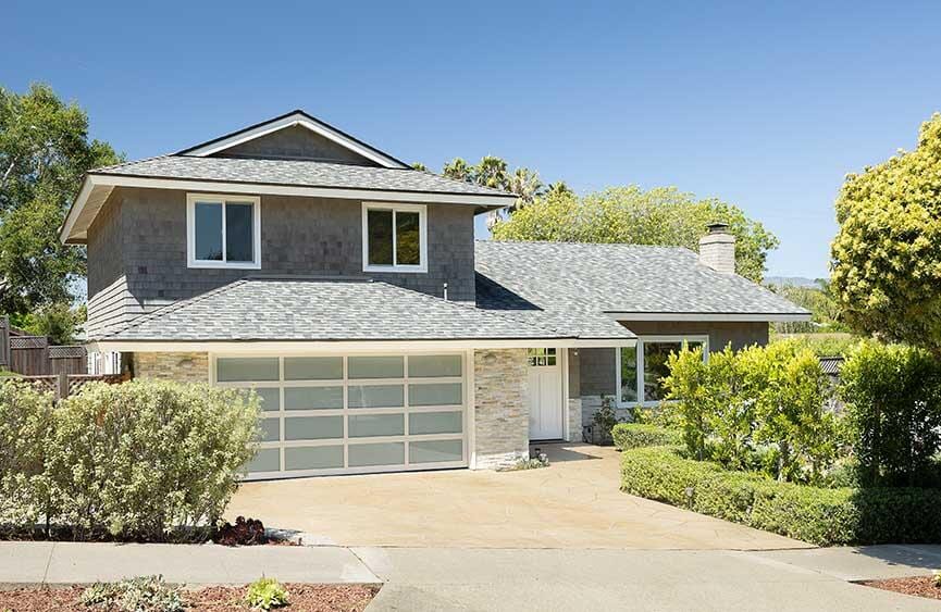
Housing in Hidden Valley spans a genuine mix of single-family homes, duplexes, and multi-family buildings rather than one dominant type, giving buyers more variety within a single neighborhood than a strictly single-family area would.
Frequently asked
Where exactly are Hidden Valley's boundaries?
The neighborhood spans about 335 acres, with Highway 101 forming the northern edge, Campanil Hill and the Arroyo Burro Creek corridor marking the southern boundary, Veronica Springs Road defining the eastern side, and Hope Ranch adjoining to the west -- boundaries drawn from the city's own General Plan.
Is Hidden Valley part of the City of Santa Barbara or the county?
It sits entirely within incorporated city limits, so city zoning rules and Architectural Board of Review apply — a contrast to adjacent Hope Ranch and Mission Canyon, both unincorporated county territory.
What does the housing stock look like?
City zoning data shows single-family lots covering the southern and eastern portions at roughly five units per acre, while a northwestern strip near Hope Ranch carries denser duplex and multi-family zoning at about twelve units per acre. A narrow low-density band bordering Hope Ranch itself allows only about one unit per acre. Citywide records counted 966 dwellings in the neighborhood.
Is this the same 'Hidden Valley' as the equestrian community near Lake Sherwood?
They're unrelated. The Santa Barbara neighborhood covered here sits between the Las Positas corridor and the Veronica Springs area; the Lake Sherwood-area 'Hidden Valley' is a separate, unincorporated Ventura County community near Newbury Park with no connection to this one.
Which schools serve Hidden Valley addresses?
Adams handles elementary, La Cumbre junior high, and San Marcos high school, according to Santa Barbara Unified's street-level attendance rosters that route most Hidden Valley addresses this way. One stretch of Modoc Road and a segment of Las Positas Road are the exception, feeding La Colina Junior High along with a separate elementary campus—so check the district's boundary tool for whichever street you're eyeing rather than assuming the three-school default.
Is there a park within the neighborhood?
Hidden Valley Park runs along Arroyo Burro Creek on 9.57 acres, with a lawn, barbecue facilities, a playground built for children ages two to five, and a creekside path that allows on-leash dogs.
How does the neighborhood connect to the beach?
The Las Positas-Modoc bike-and-pedestrian path, finished in March 2022, gives the neighborhood a paved 2.6-mile route to Hendry's Beach, also called Arroyo Burro Beach, across a dedicated footbridge.